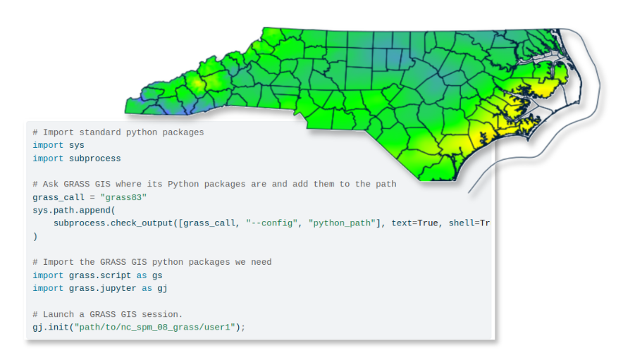
Support GRASS
Hands-on tutorials for learning GRASS, an open source computational engine for geospatial processing and analysis.
Learn how to run GRASS in Jupyter Notebooks on Windows.
Learn how to analyze geospatial data with Python in Google Colab.
Learn how to use GRASS and R to analyze geospatial data.
Learn how to analyze geospatial data with Python in Jupyter Notebooks.
5 simple steps to get you started with GRASS using its graphical user interface (GUI).
Species distribution models to predict the current and future distribution of the Almond-eyed Ringlet.
Generating a cumulative cost surface and least cost path with r.walk and r.path to model movement by walking across a landscape.
Workshop introducing the r.topmodel tool for hydrologic modeling.
Habitat suitability map for the white-tailed deer using spatial multicriteria analysis and spatial disaggregation in GRASS.
Workshop taught at FOSS4G 2022 and 2024 demonstrating the use of GRASS tools for Remote Sensing data processing analysis in Jupyter notebooks within Google Colab.
Tutorial on different types of raster time series aggregations, i.e., with granularity, full series, long term averages, and their visualization.
Introductory tutorial on raster time series creation, management and visualization in GRASS.
Use a suitability map to identify and map regions with defined minimum suitability scores and area size.
Quick review of tools to make plots for raster, vector and time series data in GRASS.
Comparison of R and Python GRASS interfaces to streamline the use of GRASS within R and Python communities
GRASS tutorials on ecology and biogeography topics.
Curso de postgrado sobre procesamiento y análisis de datos satelitales y series temporales con GRASS.
Series of tutorials delivered at different events addressing begginer and intermediate geospatial data processing in GRASS with Jupyter notebooks.
Estimate the forest change rate and learn some GRASS basic concepts.
Advanced geospatial analysis with GRASS GIS
Geospatial Modeling and Analysis course taught at NCSU. Several topics are covered with GRASS.
A course on GIS for landscape architects, urban planners, and other designers using GRASS.
Tutoriais GRASS em português.
Create maps of tree species diversity across the contiguous USA, using various diversity indices.
This workshop introduces GRASS and the FUTURES urban growth modeling framework.
Series of tutorials on time series processing for environmental modeling delivered at OpenGeoHub summer school 2019.
Hands-on workshop delivered at FOSS4G Boston 2017 showcasing GRASS tools for processing point clouds.
Tutoriales de GRASS en grasswiki traducidos al español.
This is a FOSS4G 2014 workshop on GRASS time series data handling and visualization.